From May 9th to May 20th was Interpretative Training at Wrangell St. Elias National Park and Preserve. Below is a photo journal of those days! Enjoy!

Loess flying around on the Copper River.

Copper River

Ice breaking up along the Copper River.

Willows sprouting

Mt. Sanford

The land ethic of local Slana residents, nicely said.

Our cabin with a view at Huck Hobbit's,
our training base camp.

Beautiful interior of our cabin.

The front porch of our cabin.

Willows at sunset.

Huck Hobbit's main house, the Hobbs family homesteaded here during the last and final homesteading in the US. (1980's)

Their sunroom.

Great idea for a greenhouse, super warm on a cold day!

Sheds and harvested racks.

Wolves and various other pelts...all a subsistence way of life. They make goods and earn their living off the land.

The Alaska Range at sunset.

A training hike down to the Copper River from the Slana Ranger Station...lots of snow still on the river basin.

Keeping warm on a cool, sunny day.
(L to R: Dan, Kristi and Angela)

I had just missed a herd of caribou cross this opening,
right in front of our cabin!

The Rock N Roll homestead, a nearby abandoned homestead. Used to be housed by biker hippies.

The sign for their greenhouse,
they grew more than just house plants!

Nice shot of skull and lure.

Creeks edge, salmon make it all the way up here from the ocean!

Steve Hobbs, homesteader and owner, playing a few tunes.

More antlers on their shed.

Nice purple and pink sunset.

It snowed on the Nabesna Road, and then James locked the keys in the car...oops!

So these guys build a dirty snowman!
(L to R: Grace, Caren, Lindsay, Izzy and Dan)

Travelin in Alaska always lends great photo opps!

Biking up to Lake Louise (in the distance).

About 32 miles roundtrip, here's Lake Louise!
Great road bike trip with Willa!

Training Week 2. Apparently a lot of people ask about the Alaska Pipeline...so here's an interpretive sign to describe it.

The Interp Convoy! Holy smokes that's a lot of cars!

Ms. Moose at Chitina Ranger Station.

A stop on the confluence of the Copper and Chitina Rivers, the local spot of grabbin' salmon as they swim upstream.

The locals use fishwheels to catch the salmon.
Since the water flows down and the fish swim up,
you have to use these to grab em!

River rock.

Copper River with the McCarthy Road beginning just after that bridge.

Lots of local fishwheels.
When they grab the fish, it swings up and dumps them into a bin on the side. Then they are harvested.

Ms. Black Bear on the road. There was a small yearling, too.

Momma bear running up hill...I have a good lense here,
I was NOT that close.

Kennecott Mill Concentration building.
Bridge crossing National Creek

View of the Kennicott Glacier
from the top of the Mill building.

The northern part of Kennecott: Mechanical building, power plant, transformer building, cottages.

The shaker tables inside the Mill Concentration Plant. The limestone shook off the tables in one direction and the copper (being heavier) went another direction.

The finely ground copper and limestone powder. It would then be sent to the Leaching Plant to separate the limestone from the copper, chemically with ammonia.

Kickin' back at Erica's house.

Classy Alaskan cooking: Salmon, Caribou sausage (or Reindeer, however you want to put it), beans, and home-brewed spruce-tip beer (not pictured, but being consumed)! Thanks Erica!

Kennecott looking south

Root Glacier Trail.
The Root Glacier comes in from the right to meet up with pieces of the Kennicott Glacier (to the left of the little hill).
As it pinches Donoho peak, and the edges, it drops a lot of gravel on top as it travels...therefore, that is the glacier in the left corner, too!

Interp folks walking on Root Glacier, in the middle ground.

Interp folks on Root Glacier. It can be pretty slippery.

Anemone
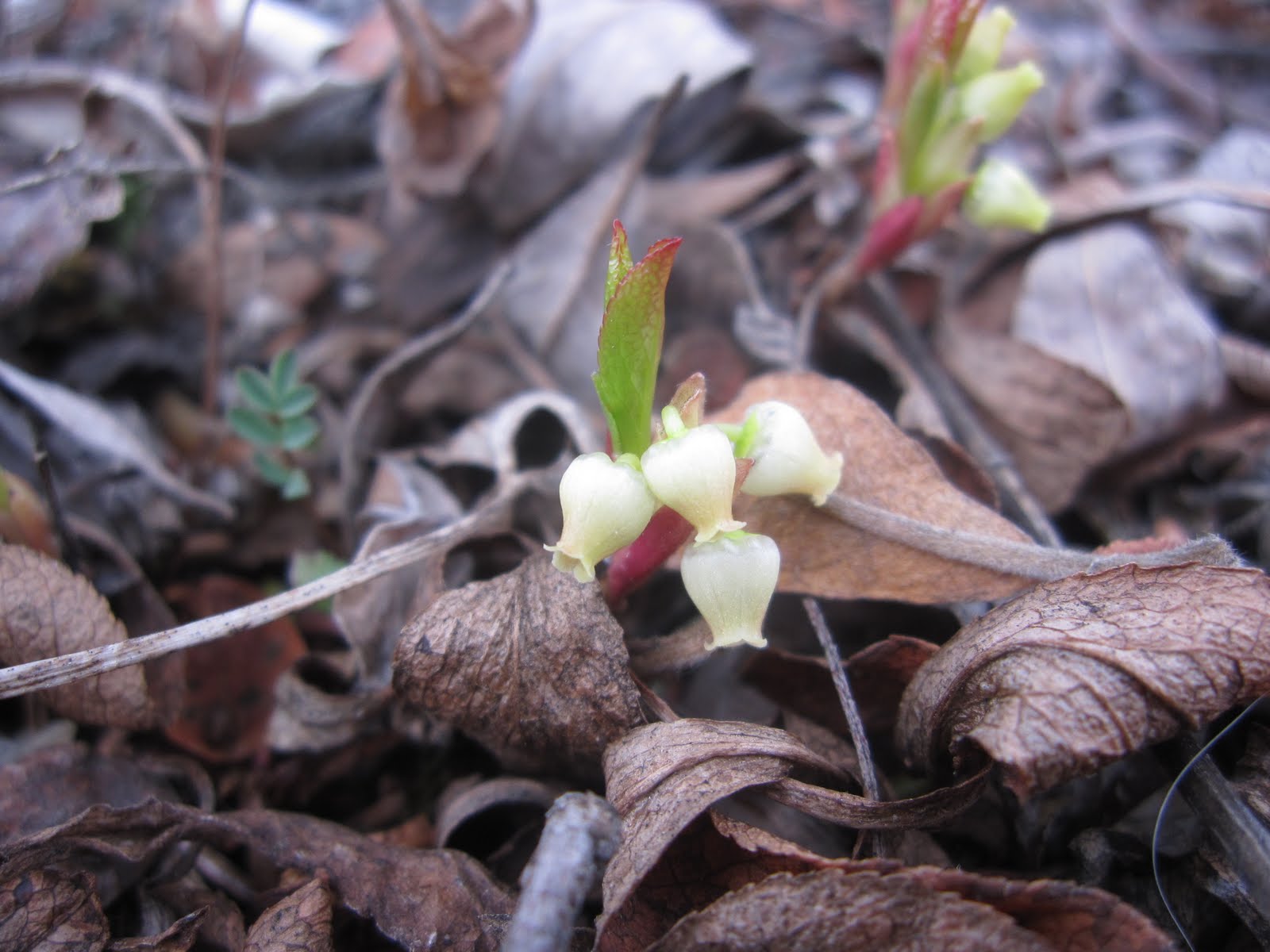
Hmmm, can't remember what this is, but it's cute. Only about an inch long.

McCarthy townsite, looking west.

McCarthy main street, looking north.

The Stairway Icefall! Amazing! Kennicott Glacier in the foreground (grey/brown).
Kennecott townsite is located on the right slope.

Again, Kennecott townsite is located on the slope straight ahead, and the Icefall is just barely visible on the left.
Great views!