
Some of the most beautiful things are just out our backdoor: Mt. Blackburn and the Kennicott Valley

Izzy and Grace with our trusty steed on the Denali Hwy.

Amazing encounters! Pete & his friend biking across the Denali Hwy, our paths cross! Safe travels, sir!

Mountains, Kettle Ponds and Fireweed

Monk's Hood, growing wild!

And grass grows in between. Tangle Lake

Delphinium, I usually see this growing in my Mother's garden!

Must be a gull's feather, along the shore of Tangle Lake.

Pieces of the Alaska Range Mountains, along Tangle Lake.

The Alaska Range from the Denali Hwy:
Amazing reflection and light. Just add a few glaciers and it's complete!
(Mt. Hayes & Maclaren Glacier on the left, Eureka Glacier to the right)

More Kettle Ponds, water features that are left over after a glacier has vacated the area.
According to Interpretive signs, they are blocks of slower melting ice that formed depressions called kettle holes or lakes.

Mt. Hayes, Maclaren Glacier, feeding Maclaren River down below.

Grace cooking dinner at our little pull-off campsite.

Moose track found in our "campsite."

Izzy and Grace enjoying the lovely Alaskan air! Is dinner ready yet?

Beer, an Alaskan sunset, and a Crazy Creek chair....can't get much better.

Maclaren Summit (2nd highest highway pass in Alaska, 4,086 ft)

More Mt. Hayes (13,382 ft.)!

Glamourous Maclaren River!

The scene was so breathtaking, all three of us sketched the scene and sat quietly on the rim.

Grand view of the Maclaren River and the Alaska Range.

Looks tasty, eh?

I really should look these up, but I'm being lazy. Cutiest tiny things, though!

I must have taken 30 of these pictures...but it was worth it! Maclaren River.

Our tent site & view.

The north Alaskan sun sets, well, not quite, at 11:30pm.

The sun sinks low, but it's never quite dark. This is around 2am.

And the sun rises from the east! Jump for joy, another beautiful day in Alaska!

The Milepost mentions that carbon dating aged this mud cliff at 10,000 years old! Thanks glaciers!

Driving to heaven, at milepost 45.1 on the Denali Hwy.

Near Clearwater Creek (which we filtered amazing water from!), we drove over Eskers, a ridge made of silt, sand, gravel, and boulders carried by a stream beneath a glacier. According to the Milepost, these are some of the best examples in North America!

Susitna River flowing in the valley below, moon above.
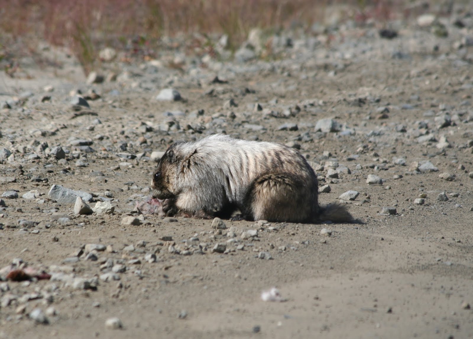
A marmot eating something: ground squirrel or snowshoe hare.

Susitna River and bridge, a combination multiple span and deck truss, 1,036 feet long. To the right, up trail are mining claims...discovered in 1903, closed in 1995, producing 495,000 ounces of gold!

Looking northwest on the Susitna River Bridge.

Sweet views of the Alaska Range! Where are those moose?

More and more Mountains!

Still no moose at these lakes....

West Fork and Susitna Glaciers...obviously receding alot back into the mountains!

Fireweed!

Izzy and Grace picking Blueberries

Fresh Wild Blueberries

Still on the stem, come and get me!

More beautiful view, lakes and mountain

Izzy and Grace: Are we in Denali yet?